April 11, 2012 - 1:35am
Students in the Advanced Diploma in GIS Applications program deliver a final presentation summarizing their practicum projects to their fellow students, instructors, sponsors and the VIU community at-large Friday, April 13.
The Advanced Diploma in GIS Applications program at Vancouver Island University provides skills training in geographic information systems, a mapping system that uses computers to collect, store, analyze and display data.
This year’s presentations, from 9 am to 2:30 pm in Building 180 (Nanaimo campus) Room 236, include 3D Archaeological Site Modeling in Prince Rupert, Travel Analysis of the Qualicum School District and Forest Health Hazard Mapping.
The presentations will be followed by the announcement of the winner of the 2012 Carto Cup, VIU’s Sixth Annual Cartographic Design Challenge.
The Carto Cup invites students at VIU from all departments and campuses to submit an original cartographic design for judging.
Paper, computer displays, three-dimensional models and even virtual reality projects are considered acceptable. The focus of the contest is portraying spatial data in an effective manner, no matter what the medium.
Past winners include:
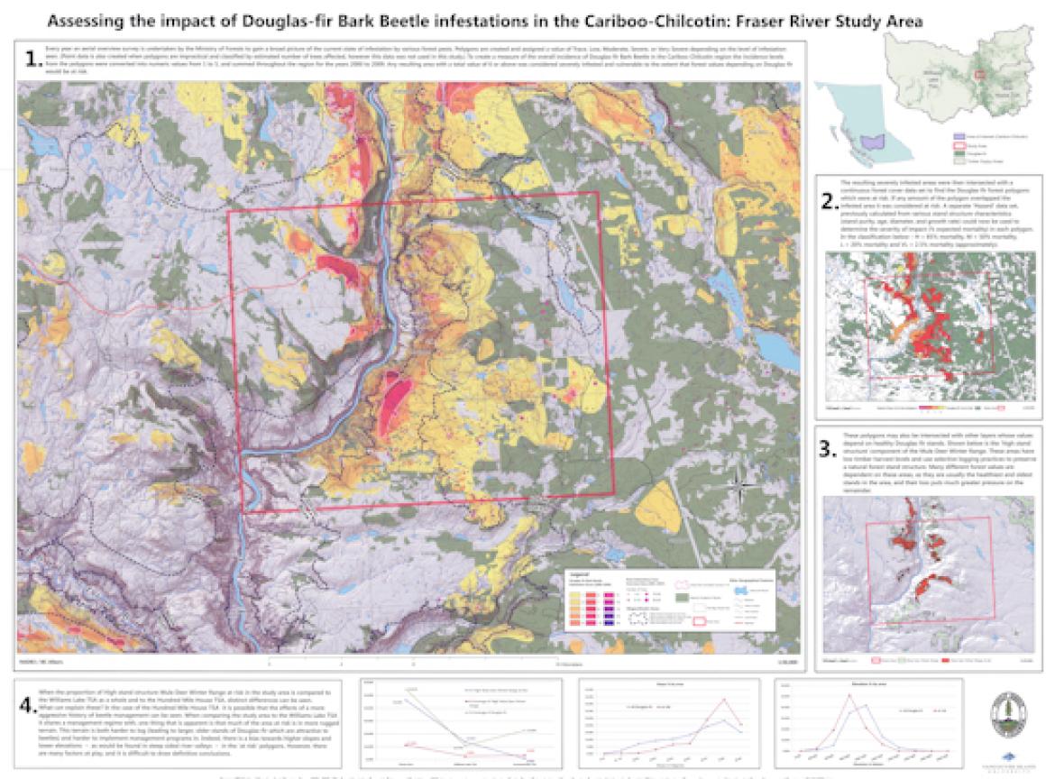
• Jonathan Bystedt (2010) created a poster showing the impact of the Douglas Fir Bark Beetle in the Cariboo-Chilcotin Region of BC and the methods used for assessing the impact of the infestation.
• Shari Willmott (2009) submitted an informational map that was designed to capture the attention of passers-by and inform them about the risks posed by the migration of the non-native American Bullfrog on the Saanich Peninsula of Vancouver Island.
• Lisa Zetterberg (2008) mapped Sensitive Ecosystems of the Okanagan Valley. It was the result of her practicum in the Advanced Diploma in GIS Applications program.
• Jay Kirby (2007) submitted a poster documenting the geological features found on his Geography 390 Field Trip which focused on the Canadian Cordillera.
• Steve Platt (2006) submitted a series of maps showing the interaction between bears and humans in the Penticton-Okanagan Falls area of BC.
VIU’s Advanced Diploma in GIS Applications program teaches students how to use GIS as a spatial information and problem-solving tool in addressing real-world issues or problems.
For more information:
Tags: In the Community