May 7, 2013 - 7:45am
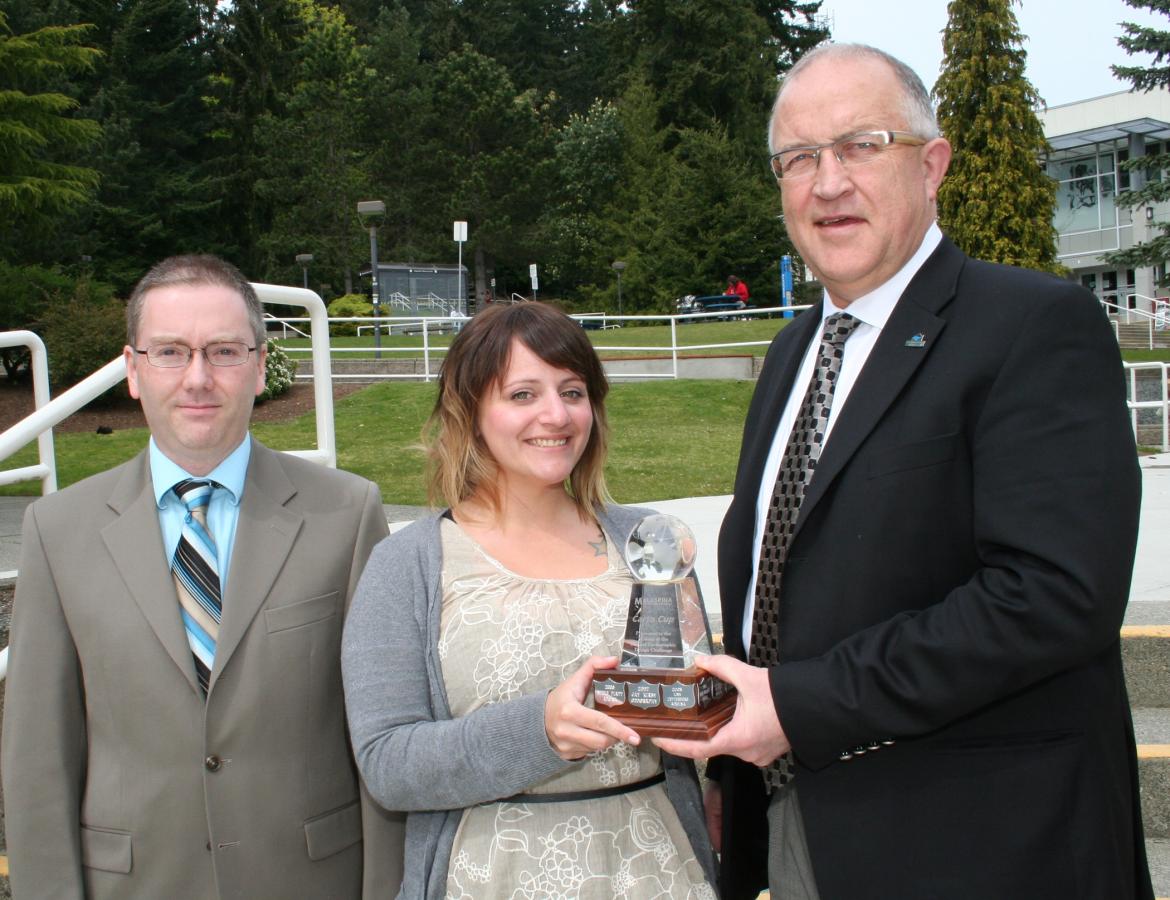
Graduate Shaunda Devenport is the winner of the 2013 Carto Cup in a cartographic design competition held at Vancouver Island University.
Organized by VIU’s Advanced Diploma Geographic Information Systems (ADGIS) Applications program, the competition invites students from all departments to submit an original cartographic design for judging.
Devenport entered a poster in the competition after completing a practicum project with the Cowichan Valley Regional District (CVRD) that modeled what will happen if the sea level rises along the CVRD coastline.
She determined the exact area that is expected to be flooded in the CVRD by 2100 as a result of sea level rise due to global warming. This information will help the CVRD to reduce future risk and liability as a result of environmental changes happening at the present time.
“Coastal flooding is a major concern to coastal communities, and the creation of coastal flood plain maps assist in the delineation and visualization of at risk areas from those areas not at risk,” says Devenport. “One of the main causes of coastal flooding historically, has been due to astronomical tides, also called King tides, and storms.
“The estimation of potential flooding from these events has often been based on a stationary mean sea level, however, scientific agencies indicate that sea level rise is occurring (due to global warming) and will continue to increase over the next two centuries. Therefore, it is necessary to factor in sea level rise when delineating coastal hazard areas,” she adds.
Using provincial methodology from the document, Coastal Floodplain Mapping -Guidelines and Specifications, produced by the Ministry of Forests, Lands and Natural Resource Operations in 2011, Devenport determined a 2100 flood construction level for the CVRD coastline that incorporated a one metre sea level rise.
Because such a large study area makes it difficult to effectively visualize the information in a map form, Devenport chose to create a poster focusing on three communities along the coast. For each community, she created a floodplain map, an inundation depth map, an ortho imagery map, and a 3d visualization map.
“Shaunda’s poster was an extremely professional piece of work,” says instructor Brad Maguire. “Her practicum sponsor and her instructors were very impressed with the results of her project. She is an exceptional student.”
Devenport also achieved the highest overall average grade point average in the program for 2013, and was nominated by faculty for a major scholarship.
She earned a Bachelor of Arts in Geography from VIU in 2012 and as part of her degree, took an introductory course in GIS. Last year, she enrolled in the ADGIS program because there is a demand for technical graduates with cartographic design skills.
“I am honoured to have my work recognized and that my submission was chosen this year,” says Devenport. “I thoroughly enjoyed the ADGIS program. It was a great opportunity for me to develop my GIS skills, with plenty of hands-on assistance from outstanding instructors. The practicum portion of the program provided me with a chance to incorporate my newly developed skills in a work place environment, experiencing all the trials and tribulations as well as success that accompanies working for an organization.”
Devenport is currently taking more online training through the ESRI Canada scholarship she received and working part-time at Harbour Air Seaplanes while she seeks employment in the field.
VIU’s ADGIS program provides skills training in geographic information systems, a mapping system that uses computers to collect, store, analyze and display data.
The program teaches students how to use GIS as a spatial information and problem-solving tool in addressing real-world issues or problems. This eight month program begins in September at VIU’s Nanaimo campus. There is also a 16-month online program that begins in January.
For more information, visit the Carto Cup website, (socialsciences.viu.ca/carto-cup) or See VIU's Advanced Diploma in GIS Applications website (socialsciences.viu.ca/adgisa).
-30-
Media Contact
Janina Stajic, Communications Manager, Vancouver Island University
Twitter: @VIUNews
Tags: In the Community